
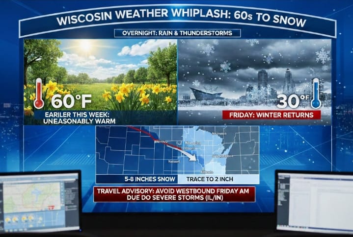
This weather forecast for southeastern Wisconsin details a significant and rapid transition from unseasonably warm, spring-like conditions to a return of winter weather. Earlier in the week, temperatures soared into the 60s, but this warmth is quickly giving way to a more typical February climate. Overnight, the region can expect widespread rain and thunderstorms, although severe weather is not anticipated in southeastern Wisconsin. The rain is projected to transition into snow around sunrise on Friday, particularly in the far western counties by the early morning hours.
While parts of western and central Wisconsin are bracing for substantial snowfall—potentially 5 to 8 inches in some areas—the Milwaukee metropolitan area and its immediate surroundings, including Kenosha and Port Washington, are forecast to receive very little snow accumulation. This significant difference is attributed to the path of a low-pressure system, which is expected to move directly over Milwaukee. The heaviest snowfall typically occurs on the northwest side of such a system, meaning the most significant accumulations will remain just west of southeastern Wisconsin. Additionally, severe weather, including tornadoes, has impacted Illinois and Indiana, making driving conditions to the west hazardous; it is recommended to avoid westbound travel on Friday morning. Looking ahead, the weekend will see temperatures in the 30s with occasional flurries, followed by dry weather early next week before another chance of light rain or snow by Wednesday and Thursday.