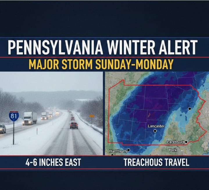
South-central Pennsylvania is bracing for a significant winter storm arriving Sunday morning and lasting into early Monday. After a dry Saturday, clouds will thicken as snow approaches from the south. While initial dry air may slow accumulation, the heaviest snowfall is anticipated Sunday evening, particularly east of the Susquehanna River.
Impacts are expected to be moderate. While primarily a snow event, meteorologists are monitoring a potential mix of rain and sleet that could suppress totals. Travelers should expect wet or slushy roads during the day Sunday, with conditions deteriorating late Sunday night. Current projections suggest 2–4 inches for most, with 4–6 inches possible in eastern counties like Lancaster. Residents should stay tuned, as a shift in the storm’s track could significantly alter these local totals.